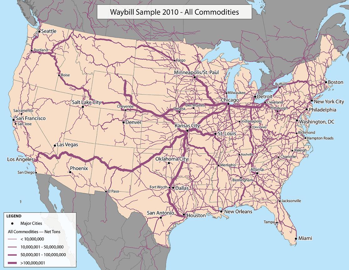
I look for a graph-based stats of the US railroad waybills. That is, the freight transported over a particular railway over a year.
So far I found:
- National Atlas 2015 - The railroad graph (network) as a shape file that can be imported in Python's networkx and other SNA software.
- Surface Transportation Board's Public Waybill Sample - A sample of a sample of the official stats collected from large railroad companies.
- Bureau of Transportation Statistics - Various stats for free. For example, the cross-border freight.
- Association of American Railroads Online Catalog - Various stats, but non-members must pay.
- Regional railroad networks (state, etc.)
A map based on STB's Sample:
The Waybill Sample is close to what I need, but I didn't find how to read their space-separated stats (no headers, codebook, or dictionary file).
So have you seen the freight stats that could be converted to a connected graph with edges like (station 1, station 2, freight)?
